

















Engineering Principles for Navigation and Lifecycle Performance
Quick Answer
A wayfinding system is an integrated navigation framework combining architectural design, environmental graphic design (EGD), signage, accessibility standards and engineering techniques.
It enables safe, efficient pedestrian movement within complex building environments.
Effective wayfinding relies on movement analysis rather than arbitrary sign placement.
Navigation information is deployed at key decision points, supported by architectural spatial cues and engineered solutions that simplify maintenance, future updates and long-term operation.
System performance is evaluated using three core metrics:
- Navigation efficiency
- Operational performance
- Lifecycle adaptability
Introduction
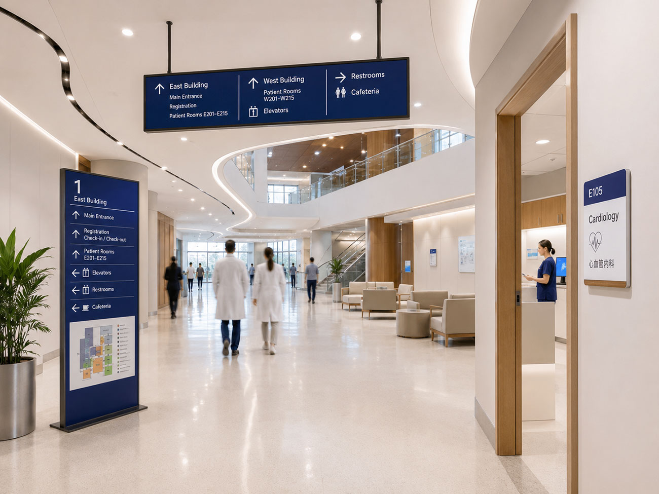
People understand a building before they read a sign.
Building entrances establish orientation.
Sightlines reveal destinations.
Circulation routes guide movement.
Architectural landmarks help users build mental maps.
Together, these spatial cues form the foundation of intuitive navigation.
This principle is supported by environmental psychology and urban design research.
Kevin Lynch’s The Image of the City introduced the concept of spatial legibility through five elements:
- Paths
- Edges
- Districts
- Nodes
- Landmarks
Paul Arthur and Romedi Passini later demonstrated that effective wayfinding improves decision-making instead of increasing the number of signs.
These principles now underpin modern Environmental Graphic Design (EGD).
Navigation planning is therefore integrated into architectural design from the earliest project stages rather than added after construction.
For architects, developers and facility managers, the key question is not:
Where should signs be installed?
Instead, it is:
How do people move through the building?
1. Prioritize Human Movement Analysis
Every successful wayfinding project begins with movement analysis.
Architectural drawings describe physical space.
Wayfinding analysis explains how people actually move through that space.
Every journey contains a sequence of navigation decisions:
- Entering the building
- Choosing a route
- Changing floors
- Confirming arrival
These decision points determine:
- Where information is needed
- What information should be shown
- How much information users actually require
Different building types require different movement strategies.
For example:
- Airportsseparate passengers, staff and service personnel.
- Hospitalsseparate public circulation from clinical and emergency routes.
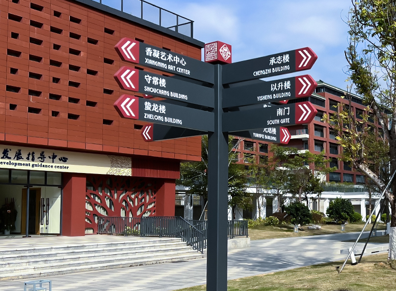
- University campusesconnect academic, research and public facilities through continuous pedestrian networks.
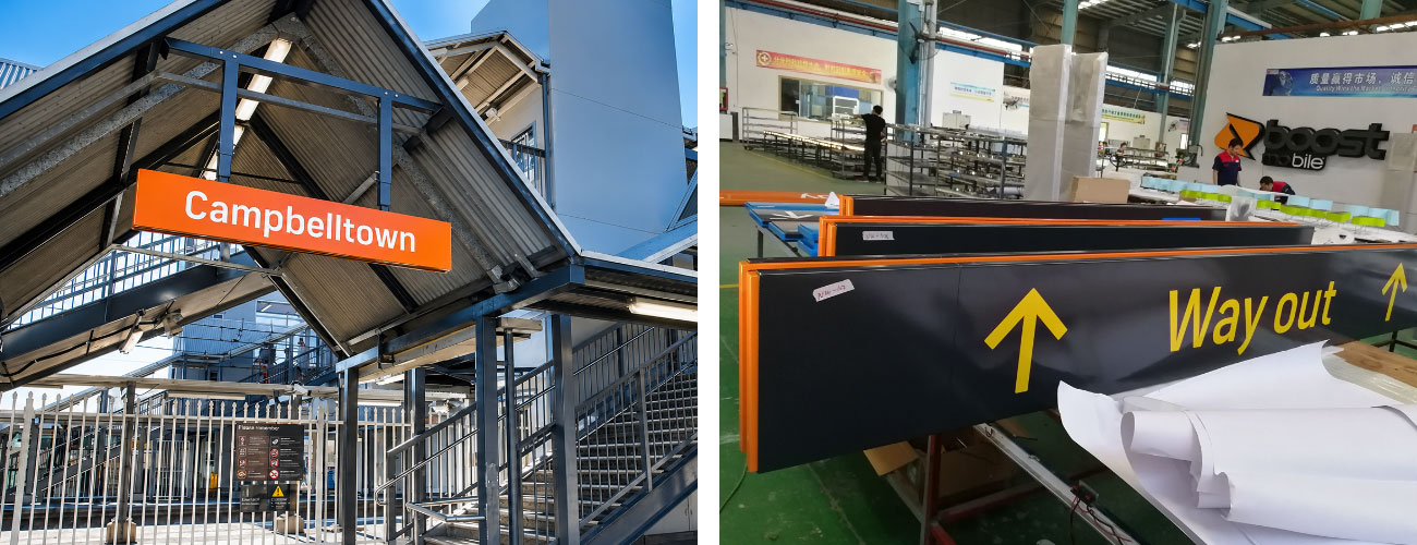
Movement analysis normally identifies:
- Primary and secondary circulation routes
- Critical decision points
- Areas where hesitation commonly occurs
- Different user groups
- Opportunities for architecture to provide orientation before signage
The objective is straightforward:
Reduce unnecessary navigation decisions.
2. Architecture Serves as the Primary Navigation System
Users navigate through architecture before they read signage.
Entrances establish orientation.
Sightlines reveal destinations.
Vertical circulation connects floors.
Lighting, materials and spatial hierarchy distinguish different functional zones.
When architectural organisation is clear, fewer signs are required.
Wayfinding should reinforce architectural logic rather than compensate for poor spatial planning.
Navigation strategy is therefore most effective when developed during the early design stage.
Architects, EGD consultants, accessibility specialists, lighting designers and signage engineers should establish one coordinated information strategy before construction documentation is completed.
Early collaboration delivers several long-term benefits:
- Better user experience
- Fewer coordination conflicts
- Consistent navigation logic
- Easier maintenance and expansion
In practice:
Architecture establishes orientation.
Wayfinding confirms decisions.
3. Progressive Information Delivery
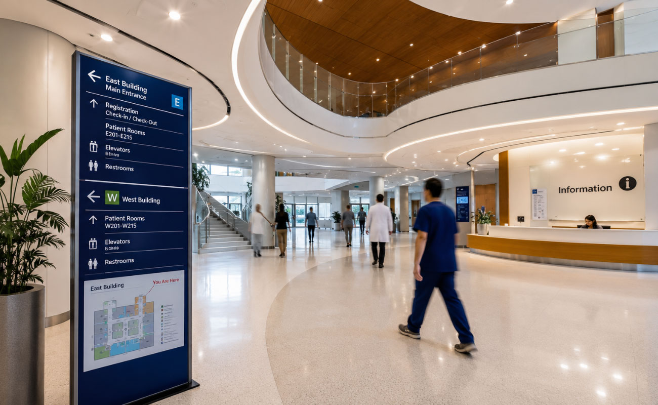
Visitors rarely read every sign.
Instead, they look for information only when they need to make a decision.
Effective wayfinding follows this behaviour by presenting information progressively.
| Journey Stage | Primary Information |
| Arrival | Entrance identification |
| Main lobby | Primary destinations |
| Route selection | Directional guidance |
| Destination | Room identification |
This approach:
- Reduces visual clutter
- Lowers cognitive load
- Improves navigation confidence
Consistent terminology and numbering systems also simplify future updates and long-term facility management.
The principle is simple:
Provide the right information at the right decision point.
4. Unified Visual Language System
Every component of the wayfinding system should follow one visual standard.
This includes:
- Entrance signs
- Directional signs
- Directories
- Room identification
- Digital displays
Consistency should cover:
- Typography
- Pictograms
- Colour
- Materials
- Lighting
- Installation details
A unified visual language improves recognition, strengthens architectural identity and simplifies maintenance and future expansion.
Accessibility should also be integrated into the same design standard through:
- High-contrast typography
- International pictograms
- Braille
- Accessible mounting heights
- Appropriate illumination
The objective is one consistent navigation experience for every user.
5. Full-Lifecycle Engineering Design
A wayfinding system is part of a building’s operational infrastructure.
It must support decades of operation, routine maintenance and continuous building upgrades.
Departments relocate.
Tenants change.
Facilities expand.
The navigation system should adapt without disrupting daily operations.
Lifecycle engineering addresses these changes during the earliest design stage.
Key engineering strategies include:
- Modular information panels for fast content updates
- Standardized fixing systems for efficient maintenance
- Durable materials selected for long-term operating conditions
- Consistent component dimensions for future expansion
- Building Information Modeling (BIM) to coordinate sign locations, mounting interfaces and asset information before fabrication
These engineering decisions provide measurable operational benefits:
- Reduced maintenance time
- Higher installation accuracy
- Lower lifecycle cost
- Faster information updates
- Easier future expansion
The objective is clear:
Design for long-term operation, not simply project delivery.
Project Snapshot
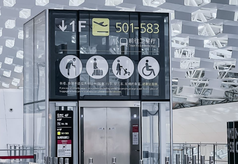
Shenzhen Bao’an International Airport
Challenge
Maintain clear passenger navigation during continuous terminal expansion while ensuring uninterrupted airport operations.
Engineering Approach
The project adopted:
- Modular wayfinding structures
- Replaceable information panels
- Standardized structural components
Sign locations, fixing details and maintenance interfaces were coordinated during the design phase to support phased expansion without replacing complete sign assemblies.
Outcome
The navigation system has remained visually and functionally consistent across multiple expansion phases.
Routine maintenance and information updates can be completed efficiently without disrupting terminal operations.
The project demonstrates an important engineering principle:
Long-term wayfinding performance depends on system coordination rather than individual sign quality.
Key Takeaways
Successful wayfinding systems consistently follow the same engineering principles:
- Start with human movement analysis.
- Let architecture establish orientation.
- Deliver information only at decision points.
- Maintain one coordinated visual language.
- Engineer for lifecycle performance.
- Design for inclusive navigation.
- Integrate physical and digital information systems.
These principles apply equally to:
- Airports
- Hospitals
- University campuses
- Commercial developments
- Public infrastructure
Because they are all based on one universal principle:
People understand places through movement.
Frequently Asked Questions
What is the difference between wayfinding and signage?
Signage refers to physical navigation elements such as directories, directional signs and room identification panels.
Wayfinding is the complete navigation system that integrates architecture, Environmental Graphic Design (EGD), information hierarchy, accessibility and engineering.
Signage is only one component of that system.
When should wayfinding planning begin?
Wayfinding planning should begin during the earliest stages of architectural design.
Early coordination allows architects, EGD consultants, engineers and facility managers to align circulation routes, decision points and sign locations before construction starts.
This reduces design conflicts, improves installation efficiency and lowers future modification costs.
Can digital navigation replace physical signage?
No.
Digital navigation complements physical signage rather than replacing it.
Users still depend on architectural cues and fixed physical signs for immediate orientation.
The most effective projects integrate physical signage, digital navigation and building management systems within one coordinated information framework.
References
Arthur, P., & Passini, R. (1992). Wayfinding: People, Signs, and Architecture. New York, NY: McGraw-Hill.
International Organization for Standardization. (2021). ISO 21542: Building Construction—Accessibility and Usability of the Built Environment. Geneva, Switzerland: ISO.
Lynch, K. (1960). The Image of the City. Cambridge, MA: MIT Press.
Society for Experiential Graphic Design. (n.d.). Wayfinding and Environmental Graphic Design Resources.
U.S. Department of Justice. (2010). 2010 ADA Standards for Accessible Design.
Conclusion
Wayfinding system performance is not measured by the number of installed signs.
It is measured by how effectively architecture, information design and engineering work together to support movement.
Clear spatial organization establishes orientation.
Progressive information reduces navigation effort.
A unified visual language improves recognition.
Lifecycle engineering ensures that the system remains efficient as buildings evolve.
Although digital technologies continue to advance, the engineering objective remains unchanged:
Deliver the right information, at the right place, at the right time.
Visitors rarely remember individual signs.
They remember whether the building was easy to understand.
That experience is the ultimate measure of a successful wayfinding system.
Need Support for a Wayfinding Project?
At COSUN SIGN, we work with architects, developers and contractors to deliver commercial wayfinding systems that combine engineering, manufacturing and lifecycle performance.
From early wayfinding planning and engineering coordination to fabrication, installation and lifecycle support, our team helps deliver navigation systems that remain reliable as buildings evolve.
Explore our wayfinding projects or contact our engineering team to discuss your project.


 粤公网安备44030702001648号