

















Large airports are not single-path environments. Departures, arrivals, transfers, security, baggage reclaim, and ground transportation create overlapping passenger journeys across the same terminal complex.
That complexity increases when travelers speak different languages, carry luggage that blocks sightlines, move under time pressure, or enter crowded areas. In this setting, adding more wayfinding signs does not automatically make navigation clearer.
Airport wayfinding signage should instead connect spatial zoning, naming rules, wayfinding signage placement, information hierarchy, digital updates, and maintenance under one navigation logic.
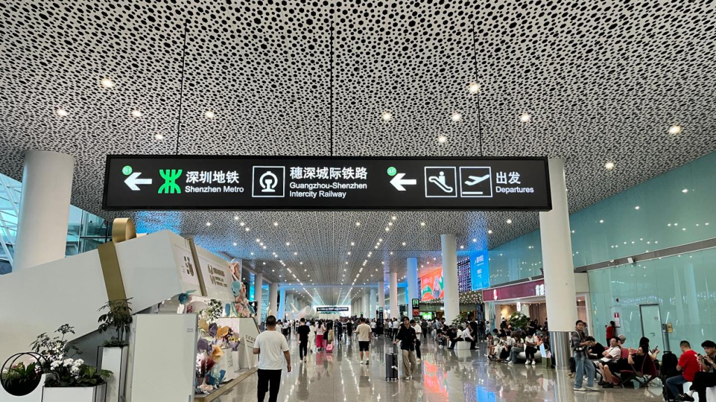
Why Large Airports Need a Wayfinding System, Not Isolated Wayfinding Signs
Airport wayfinding works best when the terminal is organized first and the wayfinding signs are designed second. Planners should define zones, destination names, passenger routes, and required information before deciding which wayfinding signage belongs at each point.
The four core journeys usually include departing, arriving, transfer, and ground-transport passengers. Each group follows a different sequence, so one information pattern cannot serve every journey equally well.
Consistency reduces cognitive switching by allowing passengers to reuse the same visual rules throughout a journey instead of interpreting each wayfinding sign from scratch. If a gate zone keeps the same name and number format, a route color always represents the same area, and arrows and pictograms follow the same conventions, passengers can recognize those cues at the next junction without relearning their meaning. A consistent information hierarchy also keeps the next required action prominent, so travelers do not need to scan every message before deciding where to go.
System design checklist
- Define terminal zones and official destination names.
- Map passenger journeys before assigning wayfinding sign locations.
- Standardize arrows, symbols, colors, and numbering.
- Match each location with the right message priority.
Mapping Passenger Journeys and Critical Decision Points
Passenger-journey mapping shows where information is needed before confusion occurs. A departing passenger may follow check-in → security → gate → boarding, while an arriving passenger may move through immigration → baggage reclaim → customs → ground transport. Transfer passengers may instead follow arrival gate → transfer security → next departure gate.
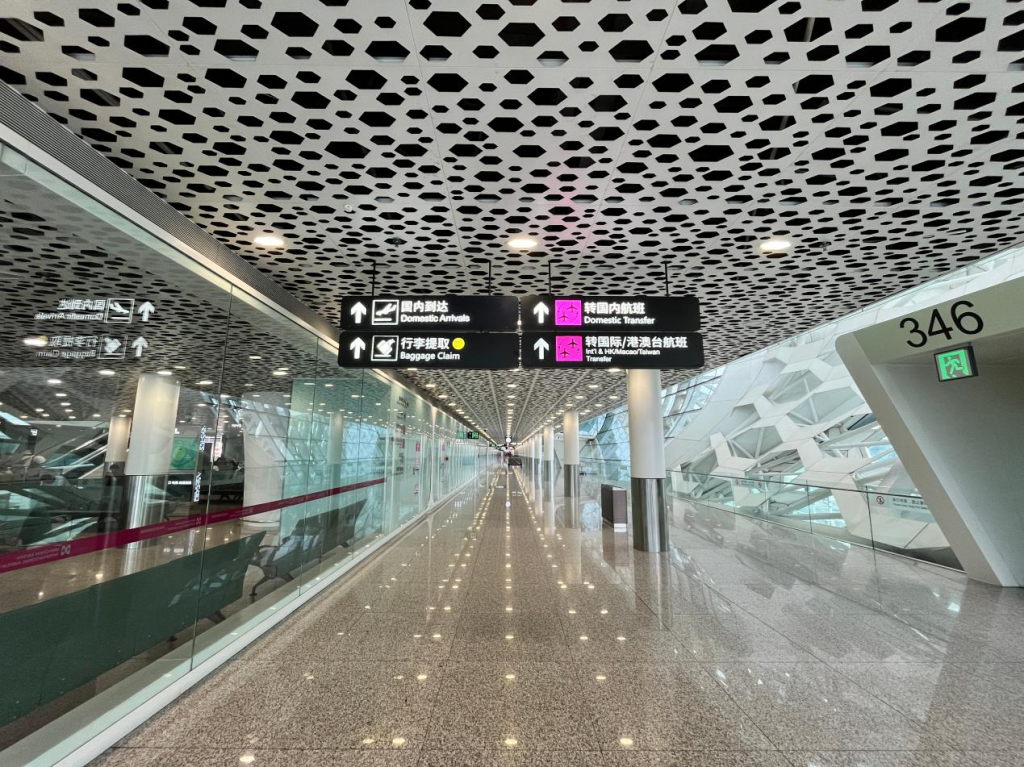
A practical placement model uses three layers: preview information before a decision point, directional information at the decision point, and confirmation signage after the turn. This reduces uncertainty after long corridors, vertical circulation, or route splits.
High-pressure locations deserve extra attention, including check-in islands, security entrances, lift and escalator intersections, gate-zone boundaries, transfer corridors, baggage halls, and transport centers.
| Stage | Purpose | Typical Location |
| Preview | Prepare passengers for the next choice | Before junctions |
| Decision | Indicate the required direction | At intersections |
| Confirmation | Confirm that passengers remain on the route | After turns |
The same sequence should continue when operations change. If a corridor closes, passengers can first receive a closure warning before reaching it, then see an alternate direction at the affected junction, followed by confirmation after entering the diversion route. Gate changes can be communicated before passengers enter the wrong concourse, while heavy security queues can redirect suitable passenger flows toward another available checkpoint. During weather disruptions, coordinated temporary messages can identify affected routes and direct passengers toward revised gates, waiting areas, or transport connections.
Multilingual Airport Navigation Without Visual Overload
Multilingual navigation should prioritize comprehension rather than placing every language on every wayfinding sign. Airports can define primary, secondary, and temporary languages by location, route structure, and passenger profile.
The hierarchy should stay simple: destination name, directional arrow, and critical number first. Longer translations, service notes, and secondary explanations can move to lower-priority panels or digital interfaces.
Use consistent terminology across hanging and wall-mounted wayfinding signs, kiosks, maps, and flight displays. Different names for the same destination force passengers to stop and reinterpret the route.
FAA airport-signing guidance emphasizes consistent terminology, symbols, and legibility. International pictograms, clear type, strong contrast, and controlled character and line spacing can further reduce dependence on language alone.
Multilingual design priorities:
- Maintain one approved terminology library.
- Keep arrows, destination names, and key numbers visually dominant.
- Apply recognized pictograms consistently.
- Separate secondary translations from primary navigation information.
Wayfinding Sign Placement and Information Hierarchy for High-Volume Passenger Flow
Wayfinding signs have different roles. Suspended directional signs support long-distance decisions; wall-mounted and freestanding wayfinding signs provide local guidance; floor markings and zone identification signs reinforce area recognition.
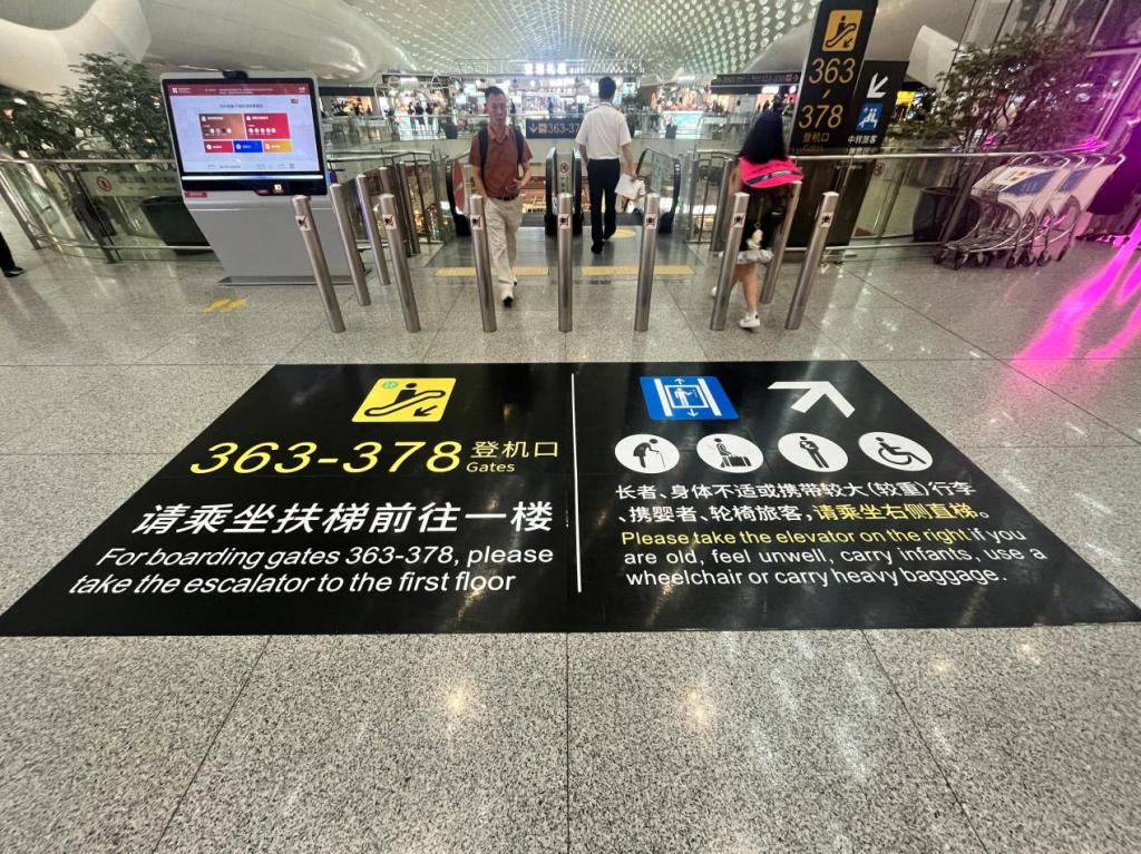
The key principle is progressive disclosure. Passengers should receive the information required for the next action at each node instead of seeing every downstream destination on one wayfinding sign.
Real operating conditions also affect visibility. Crowds, luggage carts, retail advertising, structural columns, and lighting reflections can obstruct airport wayfinding signage. Mounting height, viewing distance, contrast, and wayfinding sign orientation therefore need to be assessed under expected passenger-flow conditions rather than in an empty terminal.
Departure, arrival, transfer, and ground-transport routes can use coordinated zone names, colors, or numbering to make different flows easier to distinguish without creating separate visual systems for each journey.
Integrating Static, Illuminated, and Digital Wayfinding
Static, illuminated, and digital elements should be assigned according to how stable the information is. Permanent zone names and fixed directions are suited to static or illuminated directional signage, while flight status, gate changes, queue information, and emergency notices require content that can be updated dynamically.
Digital wayfinding signage, kiosks, and Flight Information Display Systems (FIDS) complement hanging wayfinding signs, light boxes, and zone identification signs. Passengers can check routes on kiosks, verify flights or gates on FIDS, and follow overhead directional signs.
| Information Type | Suitable Format |
| Permanent zone and direction | Directional signage |
| Flight and gate changes | FIDS or digital display |
| Route lookup | Interactive kiosk |
| Temporary queue or disruption notice | Digital signage |
| Core safety and escape direction | Fixed wayfinding signage |
Centralized content publishing becomes important when operating information changes. A gate reassignment or temporary route closure can be distributed to selected digital screens and kiosks serving the affected passenger path, helping reduce situations where different terminals display conflicting instructions.
Digital information should nevertheless have a fallback. If network connectivity, power, or a display endpoint becomes unavailable, permanent escape routes, essential destinations, zone identifiers, and safety instructions should remain visible through fixed wayfinding signage. Operational procedures can then use backup power, temporary directional signs, or staff guidance for information that cannot be restored immediately.
Engineering and Maintenance for 24/7 Airport Operations
Integrated IoT sensors continuously monitor structural and electrical status, detecting vibration, tilt or displacement, electrical faults, power overload, and abnormal temperatures. Modular structures, LED light sources, industrial-grade components, accessible service points, and replaceable parts can allow individual elements to be repaired without dismantling an entire wayfinding sign assembly.
Smart maintenance systems can also provide operators with earlier visibility into equipment conditions. Depending on the project design, monitoring can cover remote power status, electricity consumption, equipment operating state, fault alerts, vibration, tilt or displacement, overload, and abnormal temperature. These signals help maintenance teams identify which wayfinding sign requires inspection before arranging work in an active passenger area.
Maintenance planning should address:
- Safe inspection access for high-mounted wayfinding signs.
- Replaceable lighting, control, and display modules.
- Prefabricated components that shorten on-site work.
- Installation or replacement during lower-traffic operating windows.
- Interfaces and structural capacity for later system changes.
Construction planning is equally important. Work can be divided by terminal zone, with components prefabricated off site and installation scheduled outside peak passenger periods. This limits the time that work areas interfere with normal routes and reduces the need for prolonged temporary diversions.
Future expansion should also be considered from the beginning. If a terminal adds gates, transport links, or another concourse, modular wayfinding sign structures, reserved communication interfaces, and editable content systems make it easier to add destinations or modify routes without replacing the entire airport wayfinding system.
COSUN SIGN Airport Case Study — Challenge, Solution, and Result
Shenzhen Airport is an example of how airport wayfinding signage can help passengers find their way and also support daily operations in a big transportation center. The airport handles more than 50 million passengers annually. Terminal 3, the Satellite Hall, and the Ground Transportation Center (GTC) create connected paths between check-in, security, gates, transfer zones, baggage claim, and ground transportation.
Challenge: The main challenge was making sure the directional signs were the same in all parts of the terminal and all the transportation connections. In Terminal 3 travelers go from check-in halls to security and then to boarding areas. The Satellite Hall has corridors, waiting spaces and transfer passages.
The GTC adds complexity by linking passengers to metro services, taxis, shuttle buses, parking, and terminal entrances. High-mounted suspended directional signs in these areas must remain legible from a distance and support daily airport operations.
Solution: COSUN SIGN manufactured and engineered high-visibility, suspended illuminated directional signs across major circulation areas, including check-in halls, security zones, departure gates, waiting areas, transfer corridors, baggage claim, and ground-transport connections. Double-sided light boxes were installed above passenger routes to maintain visibility across large terminal spaces.
To support ongoing operations, the suspended directional signs also incorporate intelligent controllers for remote switching, real-time power monitoring, energy statistics, equipment-status monitoring, and fault alerts. Integrated IoT sensors continuously monitor structural and electrical status, detecting vibration, tilt or displacement, electrical faults, power overload, and abnormal temperatures.
Result: The integrated system supports clearer destination recognition by keeping illuminated directional information visible along long and complex passenger routes. At the same time, centralized switching and equipment-status monitoring give airport operators greater visibility into airport wayfinding signage distributed across different terminal areas.
Fault alerts and condition monitoring help maintenance teams identify abnormal equipment more efficiently, while energy-consumption statistics provide additional operational information. Modular construction, maintenance access, and expandable communication interfaces also make future servicing and system upgrades easier to manage as terminal requirements change.
Conclusion
The core challenge in a large airport is not how many wayfinding signs it contains. It is whether multilingual information, passenger routes, wayfinding hierarchy, digital data, and maintenance systems operate under one coherent navigation logic.
A well-planned airport wayfinding system maps journeys first, places information around real decision points, separates permanent and changing information, and preserves essential navigation when digital systems are unavailable.
In practice, the system should:
- guide different passenger flows through clear sequences;
- maintain consistent terminology and visual rules;
- coordinate fixed and dynamic information;
- remain maintainable as terminal operations and layouts change.
COSUN SIGN supports complex airport projects with shop drawings, custom airport wayfinding signage manufacturing, quality control, export packaging, remote installation guidance, and integrated airport wayfinding solutions.


 粤公网安备44030702001648号