

















Engineering Durable Park Wayfinding Signage for Public Open Spaces and Wetland Landscapes
Project Name: Sydney Public Parks Signage System
Time: 2016~2018
Project Snapshot
| Item | Information |
| Project Type | Public Park Wayfinding & Signage |
| Location | Sydney, Australia |
| Environment | Coastal park, wetlands and open landscape |
| Users | Residents, families and international visitors |
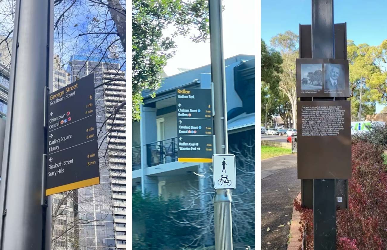
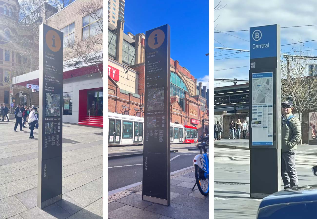
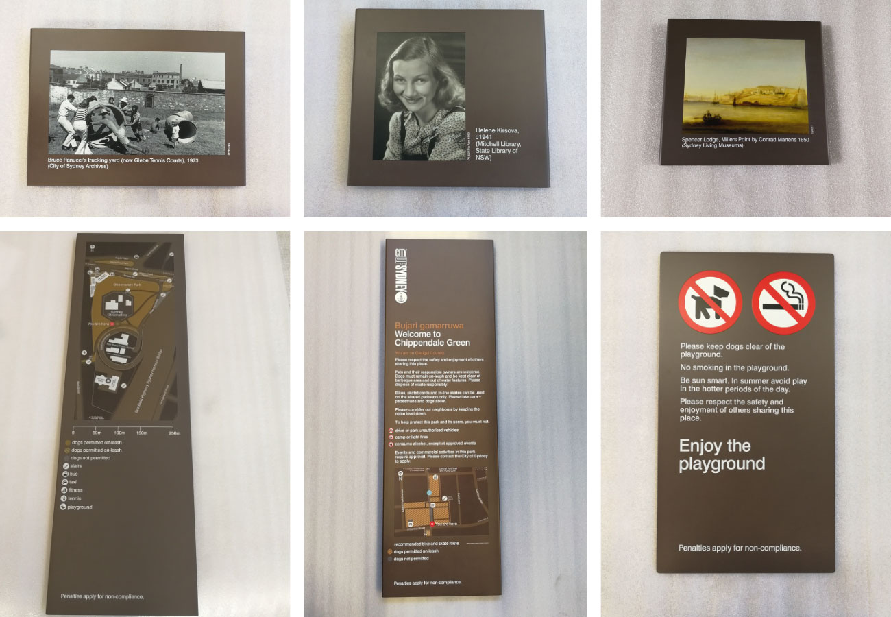
| Scope | Entrance signs, trail markers, destination identification, interpretive panels and directional pylon sign installations |
| Materials | Powder-coated steel, folded aluminium panels, UV-resistant graphics, concealed stainless steel fixings |
| Delivery | Designed and manufactured by COSUN SIGN |
Why This Project Matters
The park is designed to be explored at walking speed. Visitors move between wetlands, open grassland, lakes and viewing areas, often choosing different routes on the return journey. Navigation becomes part of the visit rather than a separate activity.
Unlike an urban street, the landscape offers few fixed reference points. Curving paths, changing vegetation and long open views can make destinations appear closer than they are. Good wayfinding does not dominate this setting; it quietly supports movement at the moments when people need reassurance or direction.
The project set out to create wayfinding for parks that would remain clear in everyday use while sitting comfortably within the landscape.
Understanding the Site
The route network links several distinct destinations, including Coastal Saltmarsh, Habitat Haven, Wetlands and Lake Northam. Each space feels different, yet visitors should experience them as parts of one connected park.
Conditions on site influenced almost every engineering decision. Summer sunlight falls directly across many open paths for most of the day. Salt carried inland by coastal winds accelerates corrosion on exposed metal surfaces. Around the wetlands, soft ground and protected vegetation limit how construction equipment can be used.
Visibility also changes from one path to the next. A sign that works well across an open lawn may disappear behind planting only a few hundred metres away. Positions were therefore tested on site by walking the routes instead of relying only on layout drawings.
Engineering Note
Sign locations were adjusted according to real sightlines and walking behaviour, ensuring information appeared before visitors reached each decision point.
Organising Movement Before Designing Signs
Navigation began with people rather than sign types.
The design team identified the points where visitors naturally pause, compare routes or look for confirmation. Those locations became the primary information nodes. Between them, smaller markers simply reassure people that they are still on the correct path.
Information is layered. Trail markers confirm direction. Larger orientation panels explain the wider park. This keeps junctions easy to read without filling every sign with unnecessary detail.
Indigenous place names are presented alongside contemporary destination names, recognising the cultural history of the landscape while remaining accessible to local residents and international visitors.
Designing Signs That Belong to the Landscape
Material selection began with climate instead of appearance.
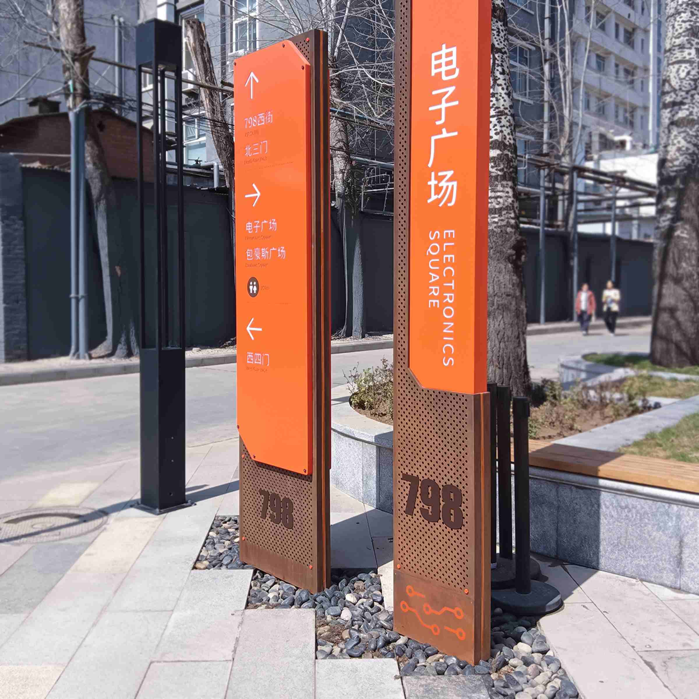
Folded aluminium panels resist corrosion and remain easy to replace if individual information panels are updated in the future. Structural posts are fabricated from powder-coated steel finished in colours drawn from weathered timber, soil and native planting. Under strong afternoon sunlight, matte surfaces reduce glare and improve legibility without increasing the size of the signs.
Graphics are printed using UV-resistant inks to maintain colour stability during prolonged outdoor exposure. Concealed stainless steel fixings protect connection points from moisture and salt while keeping visible hardware to a minimum.
The modular construction also supports future maintenance. Maps, ecological information and educational content can be replaced independently, allowing the park to evolve without replacing the supporting structure.
Material Insight
Long service life depends on replaceable components as much as durable materials. Updating a single panel is faster, less disruptive and generates less waste than replacing an entire sign.
Building Without Disturbing the Landscape
Construction methods changed as the landscape changed.
Open areas allowed conventional installation, while work near wetlands required lighter equipment and carefully planned access routes. In sensitive locations, foundations were installed with minimal disturbance to existing vegetation and surrounding soil.
Reinforced concrete footings provide stability during strong coastal winds. Concealed stainless steel anchors improve durability in a salt-rich environment while preserving a clean appearance above ground.
Installation was completed in stages so the park remained accessible throughout the project. Temporary diversions were short, clearly marked and removed as each section was completed.
What Changed After Installation
Today the wayfinding network connects entrances, wetlands, lakes and walking trails through one consistent visual language. Visitors can read the landscape more easily without the signage becoming its main feature.
The modular design also simplifies future updates. Trail maps, ecological interpretation and visitor information can change over time while the primary structures remain in place, reducing maintenance work and material consumption.
Most importantly, the signs have become part of the park’s everyday rhythm. Morning walkers, families, school groups and first-time visitors all use the same navigation system without needing to think about it.
Engineering Lessons
Outdoor navigation begins long before a sign is manufactured.
Successful park wayfinding signage grows from careful observation of movement, light, weather and terrain. Material selection responds to climate. Installation responds to ecology. Information responds to the way people walk.
When these decisions are considered together, signage supports the landscape instead of competing with it. That principle remains relevant for parks, waterfronts and other public environments where navigation should feel intuitive rather than obvious.
Project Lesson
People should remember the walk, the wetlands and the views—not the effort required to find their way.
Project Specifications
| Category | Details |
| Application | Parks, wetlands and public open spaces |
| Sign Types | Entrance signs, trail markers, interpretive panels, directional pylon sign |
| Structure | Folded aluminium panels with powder-coated steel posts |
| Graphics | UV-resistant digital printing |
| Fasteners | Concealed stainless steel |
| Foundation | Reinforced concrete |
| Features | Modular panels, layered information hierarchy, Indigenous place names |
| Environmental Performance | UV, salt-spray and wind resistant |
About COSUN SIGN
COSUN SIGN is a signage manufacturer and custom signage supplier specialising in architectural signage and wayfinding systems for public infrastructure, education, healthcare, transport and outdoor environments. As a National High-tech Enterprise, the company combines manufacturing capability with project-specific engineering to deliver durable signage for complex public spaces.
Planning a Park Wayfinding Project?
Every landscape has its own routes, climate and character. If you’re planning park wayfinding signage or wayfinding for parks, COSUN SIGN can help develop a navigation system that responds to the site, supports visitors and remains reliable for years of outdoor use.




 粤公网安备44030702001648号